|
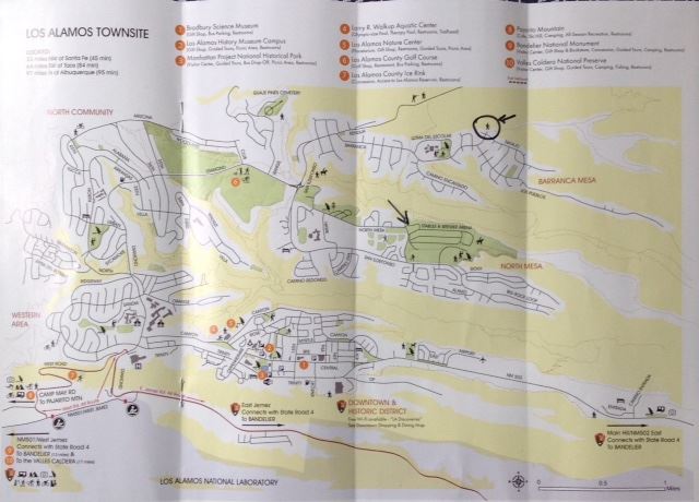
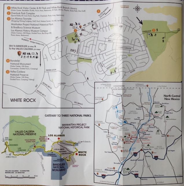
Painting Locations - Los Alamos
Plan your painting trip here.
This page is accessible by PAPNM members.
You may print this page from your browser.
Painting Location Table:
New from a local: For drama without much hiking I would try the Anderson Overlook, the Anniversary Trail and the White Rock Overlook. The beginning of Tsankawi is good too.
The underlined directions are generally google map directions.
Note the underlined blue links to (google map) directions and websites for most of the locations. They are NOT accessible out of cellular range. Recommend that you study the directions - or print them ahead of time. The google map starting point may vary. You may substitute in your desired starting point. In any case, the directions give you an idea of how to find the place once in the Los Alamos area.
Location | Directions | Overview | Parking/Facilities |

Anderson Overlook directions | Overlooks are small with traffic going by. | Parking: for 3-4 vehicles |
Drive 502 towards Los Alamos up from Anderson Overlook. It is dangerous to try to access the Anniversary Trail from below. If people are coming up the hill from below, they should continue past the pull off for the Anniversary Trail to the industrial park on the right (north) side of the highway, turn in there and head back down to the pull off for the Anniversary Trail. The industrial park is only another quarter mile up the road, so not a big detour. At the top of the hill there is a large gravel area on the left, unmarked. The trail is off the side of the lot (scroll to the right on the map a little) | Anniversary Trail is higher than Anderson Overlook with fabulous views and plenty of room to spread out. Very little if any shade. | Parking: yes but carpooling advised |
White Rock Overlook_directions
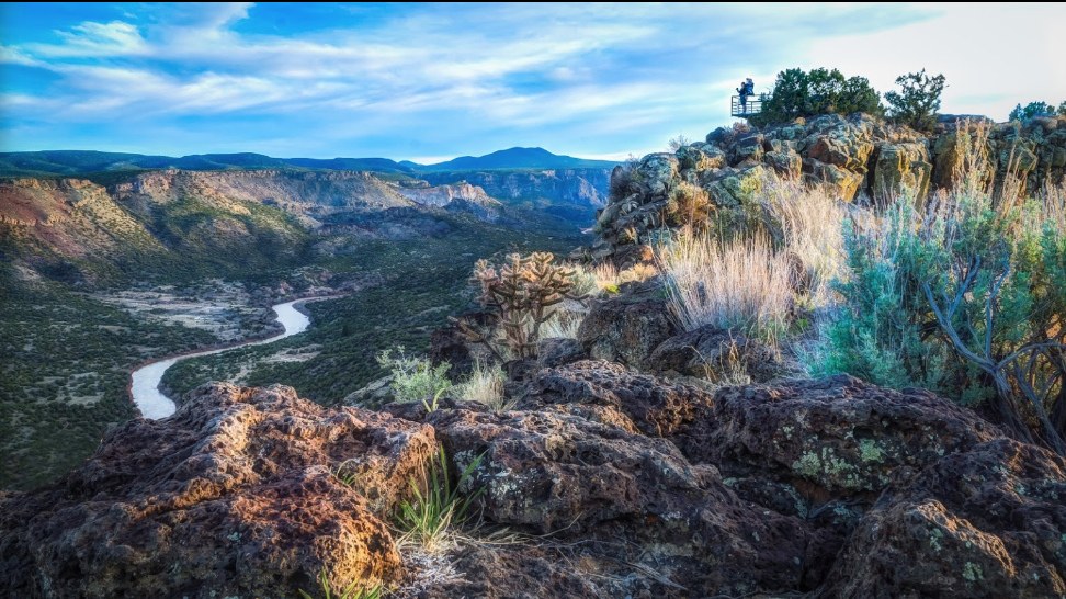
| White Rock overlook provides grand, sweeping vistas of the Rio Grande far below, the canyons of White Rock and the Rio Grande rift, the distant Sangre de Cristo range, and several prominent mesas, including Buckman Mesa and Black Mesa. Also visible from the overlook are two waterfalls. Rocky cliffs and canyon walls make for good light and shadow patterns. The hearty painter can hike down to the river itself and paint along its banks. The overlook is at the end of Overlook Park, which includes a sports complex, picnic areas, and restrooms. Cell phone reception is poor. You can get out of your car, walk about 25 feet and set up right there, or explore other areas nearby. | Parking: Yes |
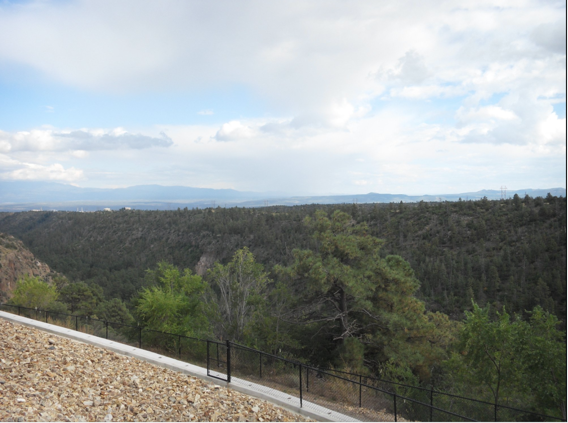
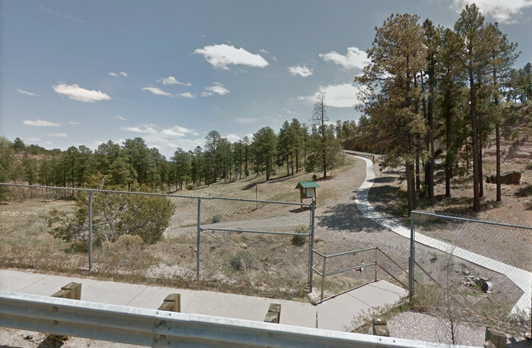
4 Canyon Rim Trailhead |
| Overlooks with wide paved trail. Somewhat of a steep grade to get off the trail to paint. Can paint from parking lot area as well. | Parking: yes, but suggest carpooling Facililities: yes |
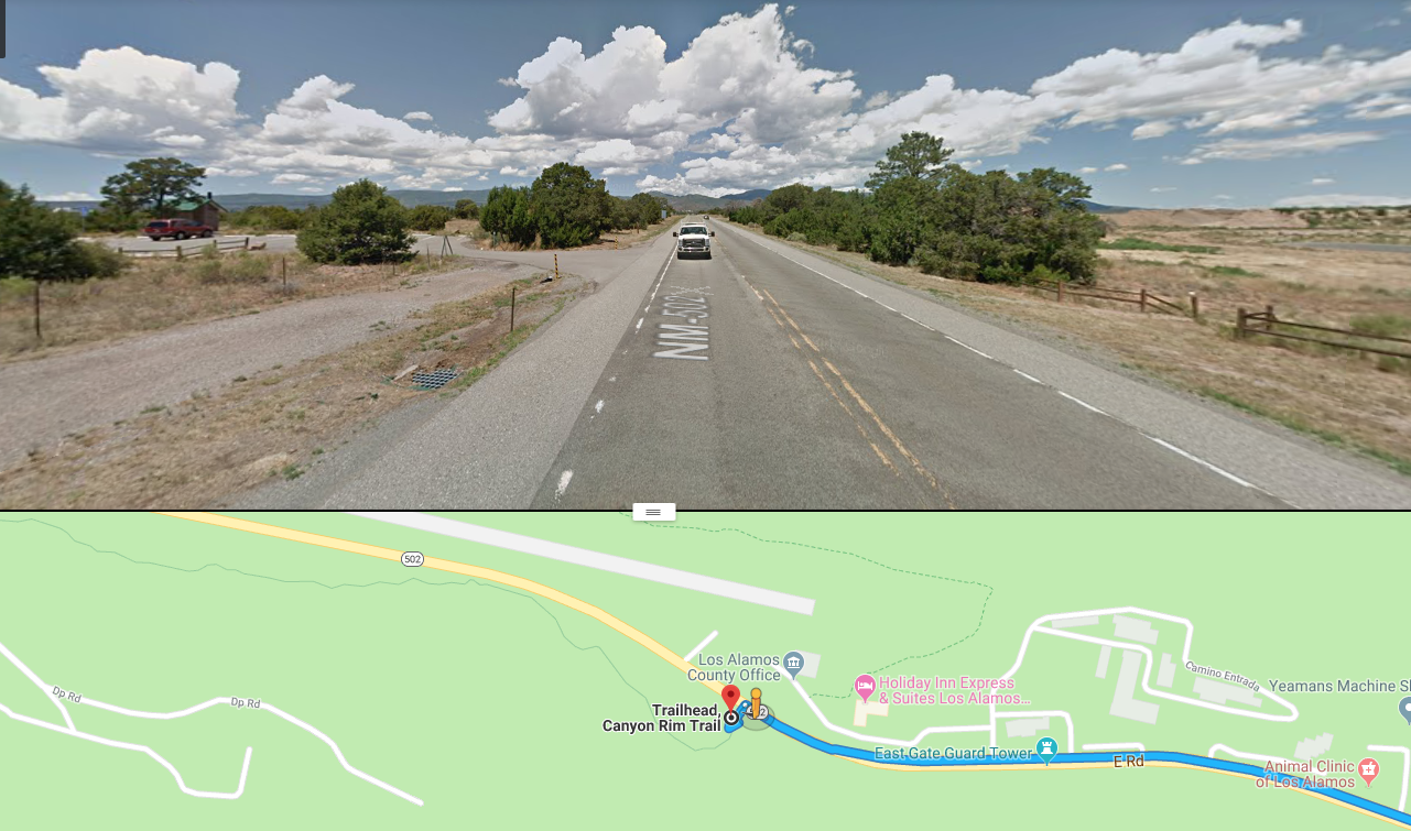
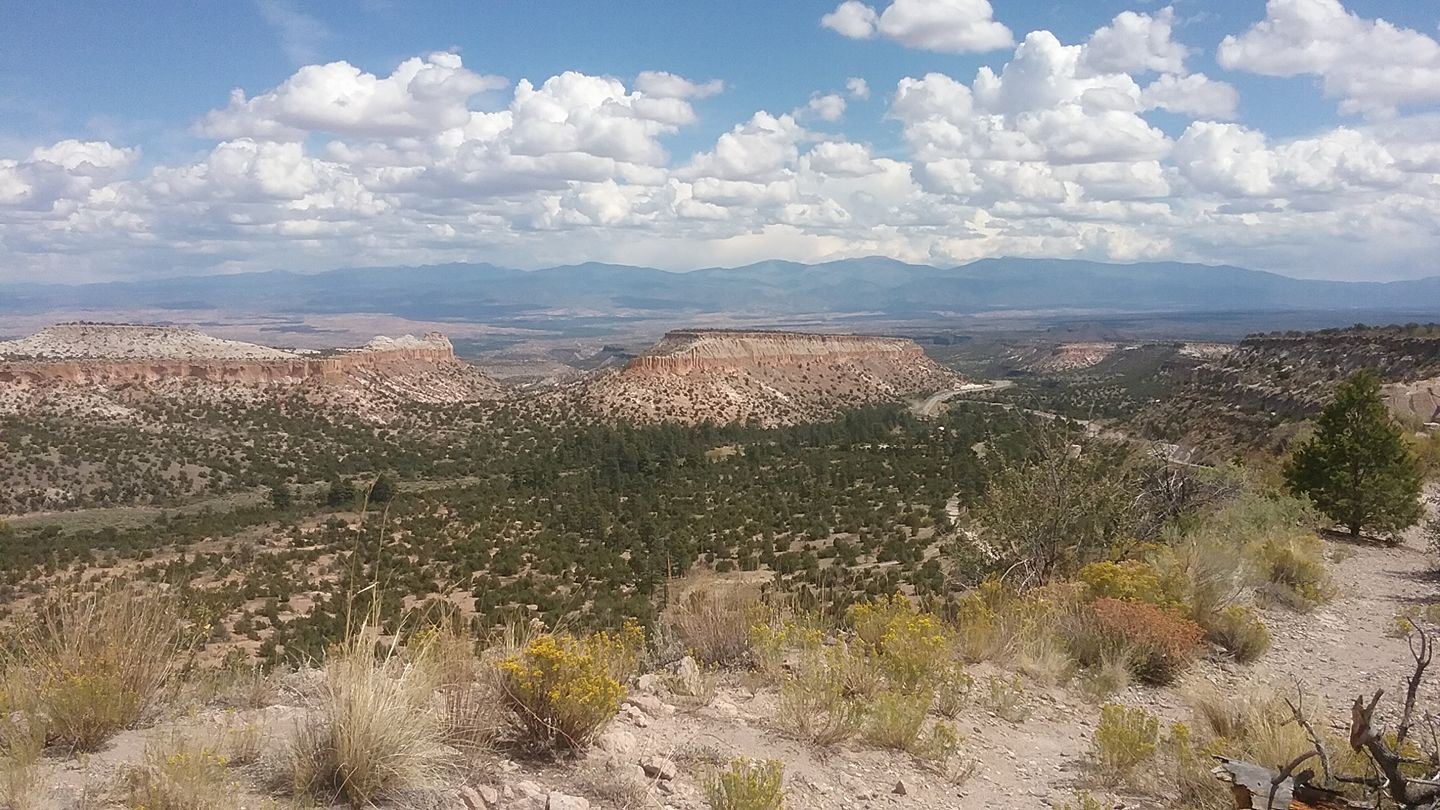
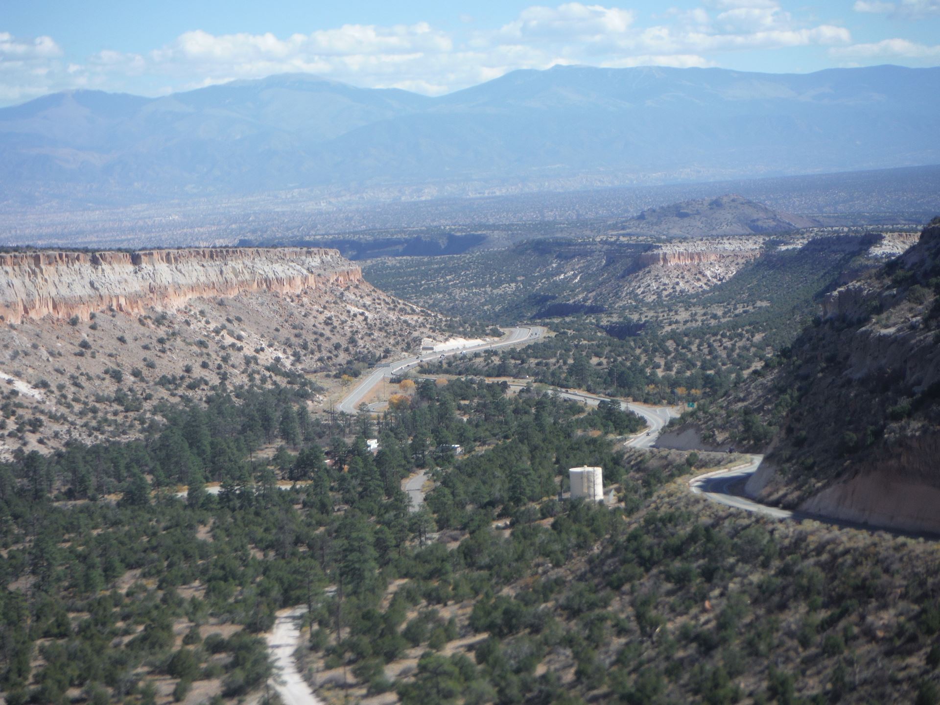
Follow US 285 N to NM502. Follow NM 502 to Los Alamos. After you are in town there is a split where 502 curves to the left and Central goes straight. Take Central Ave past Ashley Pond. Turn right into the Aquatic Center Parking lot on the right. The trailhead is just left of the entrance to the Aquatic Center | Pueblo Canyon is a deep gash in the Pajarito Plateau that runs through the center of Los Alamos. Trails follow the canyon bottom and the south rim, but the north rim is a shear wall of orange volcanic tuff, spewed as ash from the Valles caldera about one million years ago. The rim offers stunning views of the canyon and the mountains of northern New Mexico. Within the canyon are clusters of tent rocks created from dense rocks capping spires of tuff. |
7 Valles Caldera |
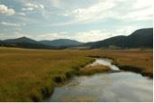
from Albuquerque: 1. Take I-25 North and Exit on to Highway 550 (Farmington Highway - old Hwy 44). 2. In San Ysidro, take Hwy 4 to Jemez Pueblo and Jemez Springs. 3. Follow Highway 4 at fork at La Cueva (stay right). From Santa Fe: 2. In Pojoaque, follow signs to Los Alamos and Hwy 502. 3. You can take the "truck route" to Highway 4 below Los Alamos or drive through Los Alamos and follow the signs to "Jemez Mtns." (Hwy 4.) If you pass through Los Alamos proper, take Trinity Drive to Diamond. Take a left on Diamond, then a right on Jemez Road to the intersection with State Highway 4. Take a right [away from Bandelier National Monument], following the highway up and into the Jemez Mountains.) 5. The Preserve is 18 miles up Highway 4 from Los Alamos. The Main Gate is at Mile Marker 39.2. Driving time from Santa Fe is about 1.5 hours. 4. Preserve is about 22 miles from Jemez Springs. Look for the Main Gate at Mile Marker 39.2. | The Valles Caldera National Preserve is the remnants of a million-year-old eruption. Hidden beyond Los Alamos in the New Mexico Jemez Mountain Range, the 89,000-acre preserve is a secret garden enclosed by a geologic wonder. It has a beautiful and wonderful view of the geological caldera vista containing wildlife, elk herds, trout streams, and even old movie set. At time of printing $25 entry fee per carload is currently being waived | Parking: yes |
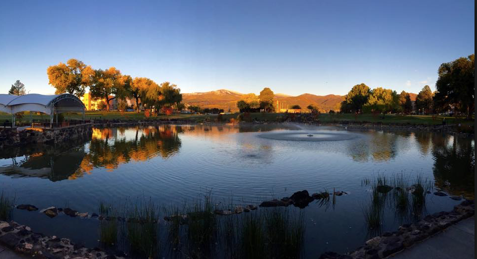
Follow US 285 N to NM502. Follow NM 502 to Los Alamos. After you are in town there is a split where 502 curves to the left and Central goes straight. Take Central Ave. Ashley Pond is on your left. | Large pond in middle of town with lots of flowers, water vegetation, fountain, and greenery. Some shade Also sculpture throughout the area. | Parking: yes off 20th street by stage |
Smith's Canyon directions (note: viewed from the back of Smith's grocery) trail_map |
| Parking: yes |
10 Los Alamos Ice Rink | Ice Rink Directions | Plenty of parking and shade. Dappled light and rockface. No distant views Omega Bridge crosses valley | Parking: yes |
11 Pajarito Ski Area | Pajarito Ski Area Directions | This road should not be traveled with a low clearance vehicle. It is extremely rough and rocky. Do not paint here alone as it is very isolated. Views overlook Los Alamos downtown and the canyons. (The ski area itself does not have a lot to paint although it has a restaurant open for lunch and restrooms.) | Parking: yes but haphazard |
12 Bayo Canyon Trailhead | Bayo Canyon Directions | Asphalt incline to canyon trail. Shade and dappled light. Must hike a ways to get back in the canyon | Parking: limited - 3-4 cars |
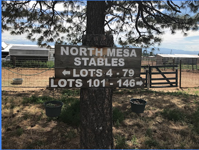
13 North Mesa Stable | 650 N Mesa Rd, Los Alamos, NM 87544 | Higgledy piggledy barns and fences and a cool assortment of creatures. Great big views of the sky, so a good place for painting clouds if you continue east along the mesa from the arena on the east end of the stables. East along the mesa from the stables is nice too, Pinon and junipers, alternating bands of light and shadow in the evening with mountain backdrops. Prefer afternoon and evening. |
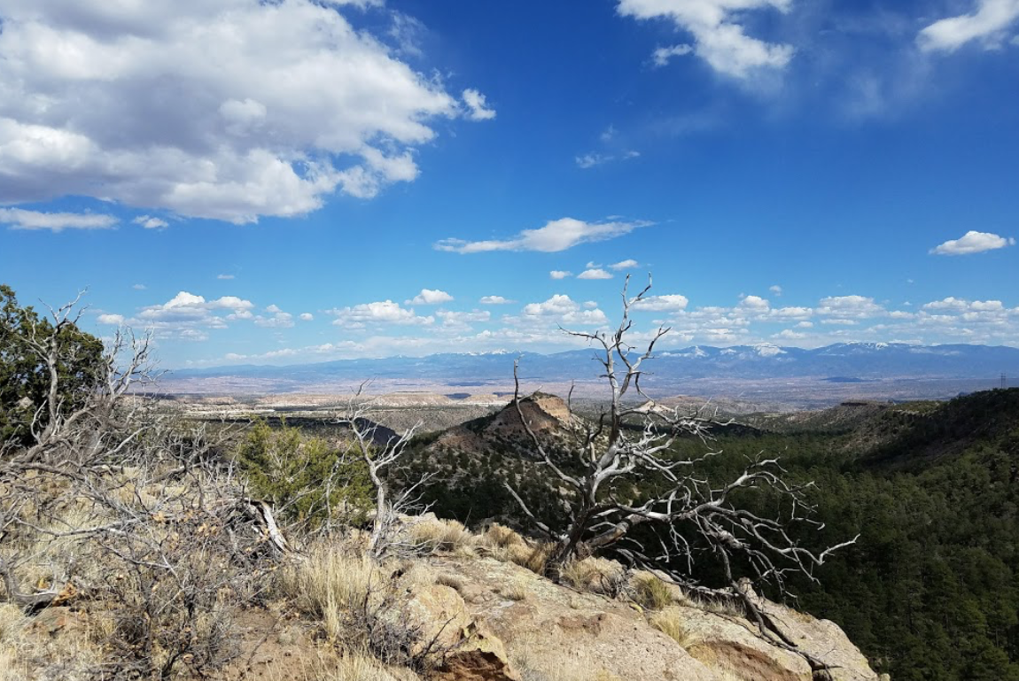
Deer Trap Mesa_directions | Great views north and east right from the trailhead. Cliffs and junipers for the foreground with big views to the east. A 4 mile loop trail tours all the lobes of the mesa with amazing views all along it. |
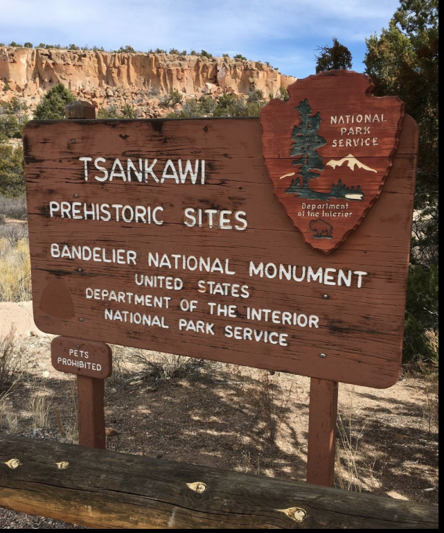
On the east side of NM 4 right next to traffic light for the intersection of NM 4 with East Jemez Road (the truck route to Los Alamos). Or come down from Los Alamos on the Truck Route. Unfortunately, Tsankawi is not the easiest place to find. Coming from Santa Fe you'll turn from State Highway 502 to State Highway 4. Less than 1/4 of a mile past this turn Tsankawi will be located on the left hand side of the road. There are no signs for Tsankawi on Highway 4. If you get to the stoplight, you've gone too far. A large gravel parking area adjacent to the highway and a sign on the fence will indicate you've found the place. Coming from Bandelier, Tsankawi is much easier to find. Just past the 3rd stoplight, the gravel parking lot for Tsankawi will be on your right-hand side. | 1.5 mile loop trail with amazing views throughout, junipers, cliffs, mesas, mountains. Great views right from the trailhead. Water and Restrooms. Part of Bandelier NM so fees apply. The trail gets lots of use, so expect lots of passersby. | Parking: yes |
You can skip the LANL security checkpoints on West Jemez Road by taking West Road through Los Alamos Canyon. You can go through the checkpoints with a driver’s license.